Introduction to ironstone gravel soil
Ironstone gravel soil types in the south-west of Western Australia vary significantly in their mineralogy and distribution within the landscape. These are characterised by several physical and chemical constraints, including low plant available water and low nutrient availability.
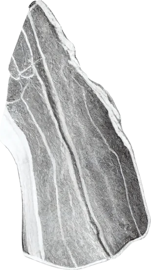
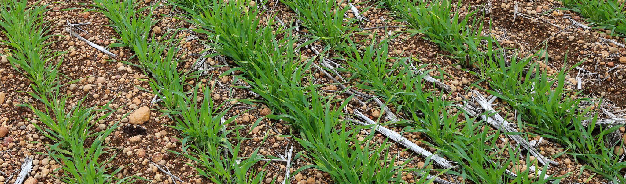
Ironstone gravel is typically red-orange-brown, hardened, rounded particles rich in iron (Fe), aluminium (Al) and silica (Si). Found in various soil types in the south-western agricultural region of Western Australia (WA), gravel particles have been formed by prolonged weathering. Technically, ironstone gravel refers to hardened particles 2 to 60 millimetres in diameter. Ironstone gravel is often referred to as lateritic gravel and elsewhere in the world, similar hard nodules have different terminology.
Introduction to ironstone gravel soil in Western Australia cropping systems
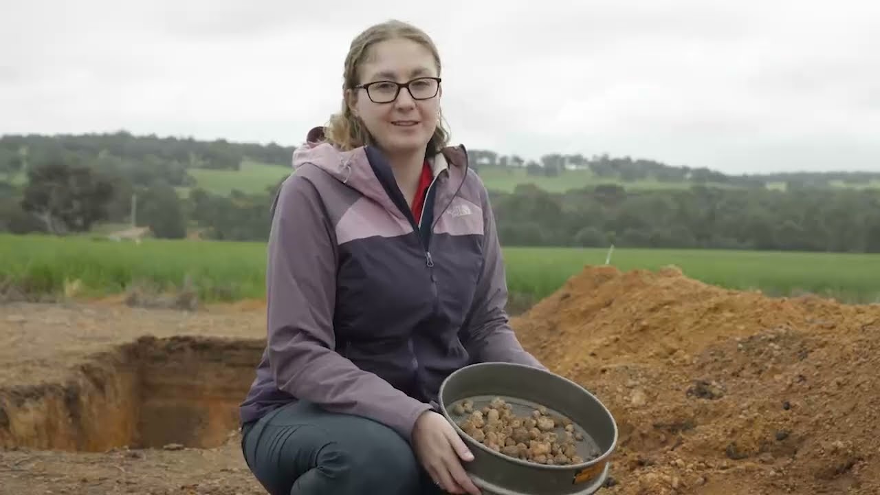
Gravel soil comprises four million hectares of the arable area used for crop production in south-west Western Australia. From Soil Quality: 9 Gravel Soil (Brailsford et al. 2023). Video: SoilsWest. Francesca Brailsford, Murdoch University.
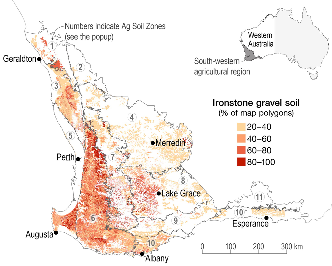
Ironstone gravel soil types are characterised by the volume of gravel (more than 20%) within the topsoil (0–10 cm), but vary spatially across the landscape in size and abundance of gravel (percent, distribution and layer thickness), fine earth texture and depth to subsoil. As such, gravel soil can be relatively hard to define. Soil likely to contain ironstone gravel is typically found in tectonically stable areas within tropical or subtropical latitudes. In Australia, nine percent of the cropland contains ironstone gravel particles. Interestingly, ironstone gravel in the south-western agricultural region of Western Australia is associated with old, deeply weathered landscapes and is the only region globally where soil with abundant ironstone gravel is widespread in a Mediterranean-type climate.
Gravel particles can decrease the amount of stored water and nutrients in the soil matrix – but can also directly store water and retain nutrients associated with their physical structure and chemical composition. Iron and aluminium oxides within the gravel particles create reactive surfaces for nutrient interaction; while silica is a chemically inert gravel component, its physical structure creates pore spaces, allowing gravel to store water. In some cases, gravel can provide more nutrients to plants than the soil matrix.
The volumetric composition of gravel in soil may result in a concentrating effect of inputs (such as herbicides and fertilisers), acidity and soil ameliorants (such as lime and gypsum) within the soil matrix. The composition and spatial distribution of gravel also has implications for surface water infiltration and runoff (volume and rate), load bearing and compaction, as well as plant and root growth. It is also an essential parameter for the calculation of soil organic carbon stocks and nutrient budgets to depth.


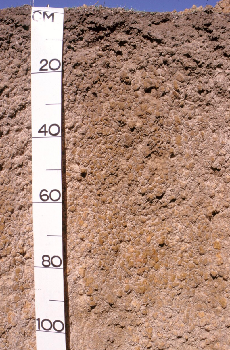
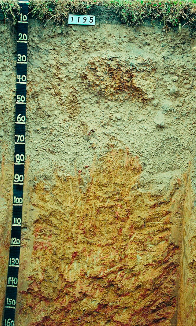
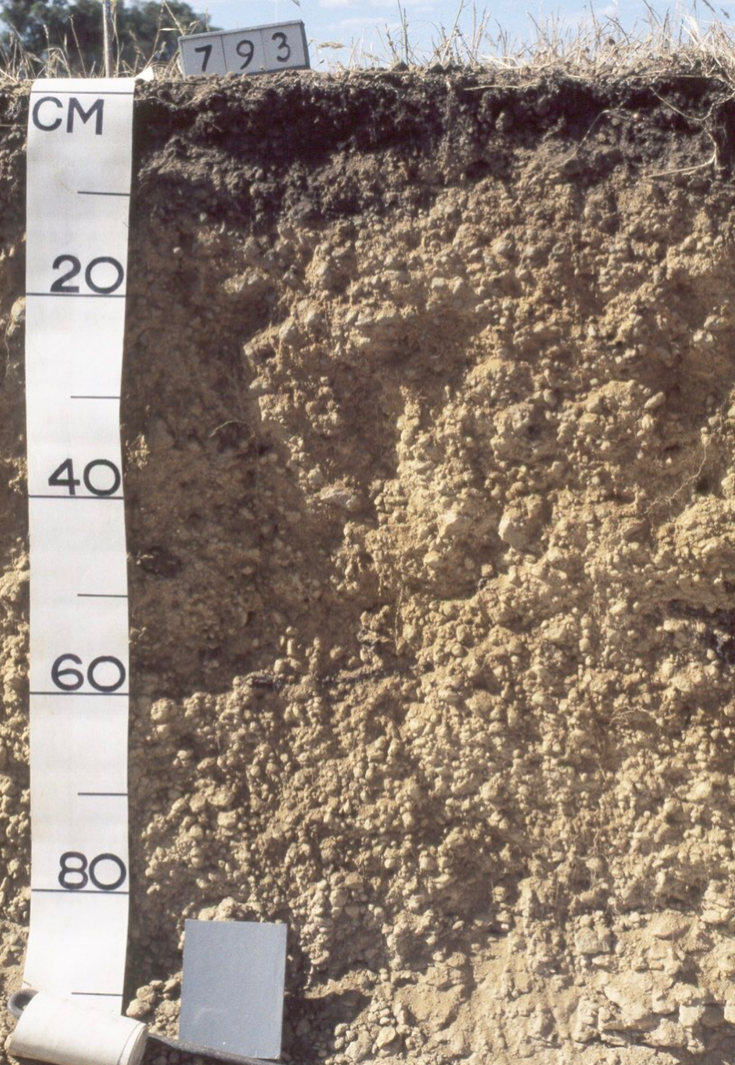
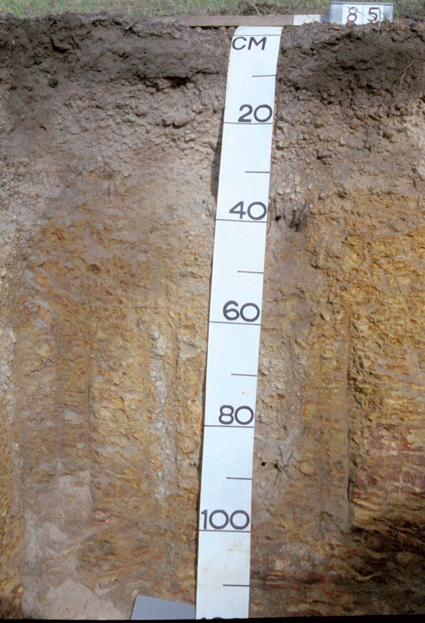
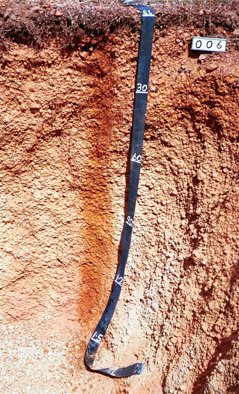
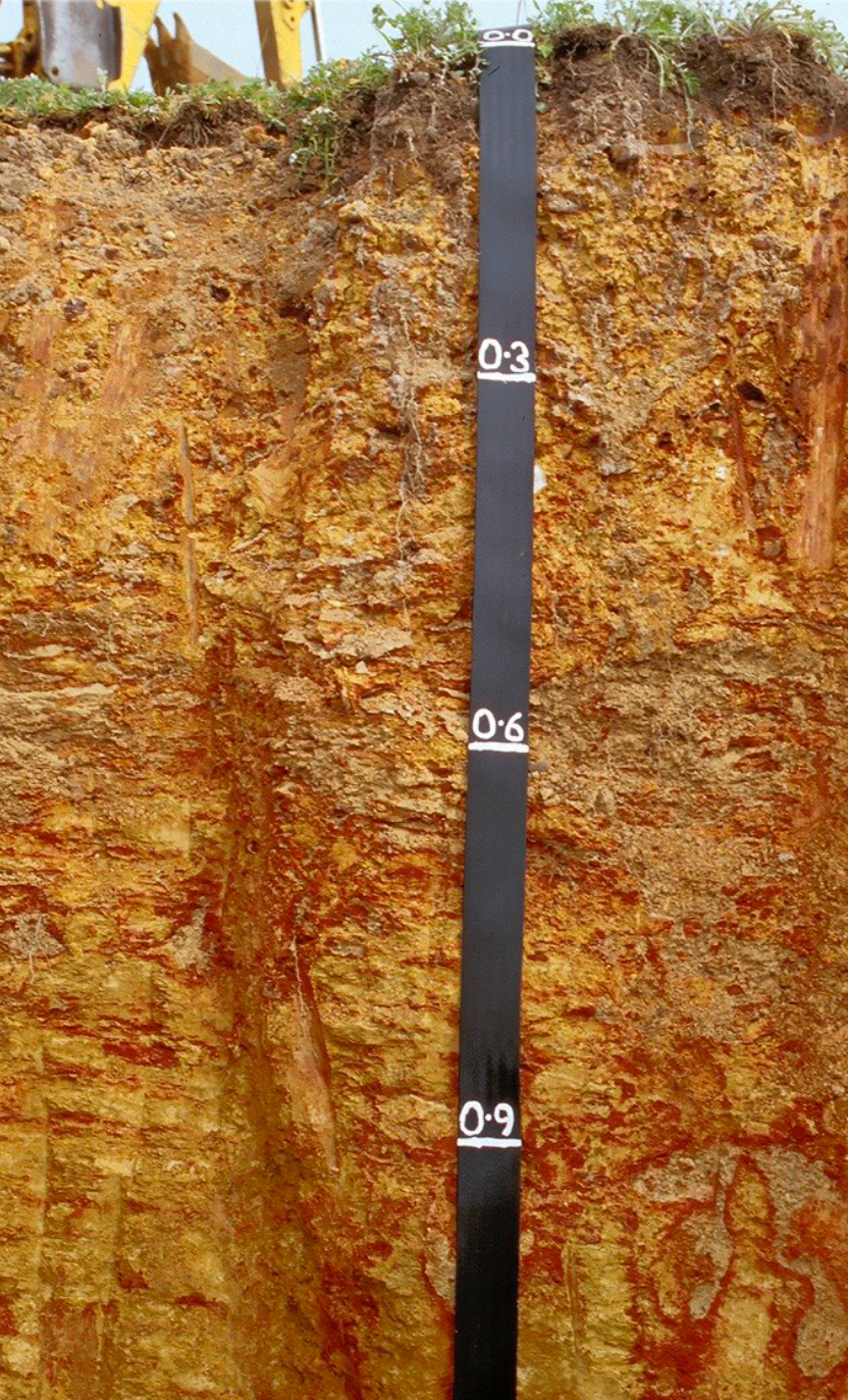
Many soil types in Western Australia contain gravel. The gravel distribution, abundance, mineralogy, soil, climate, and the land-use will affect the strengths and limitations of that soil type for agricultural production. Below are some examples of soil profiles containing gravel from Western Australia.


Impact of gravel on soil properties
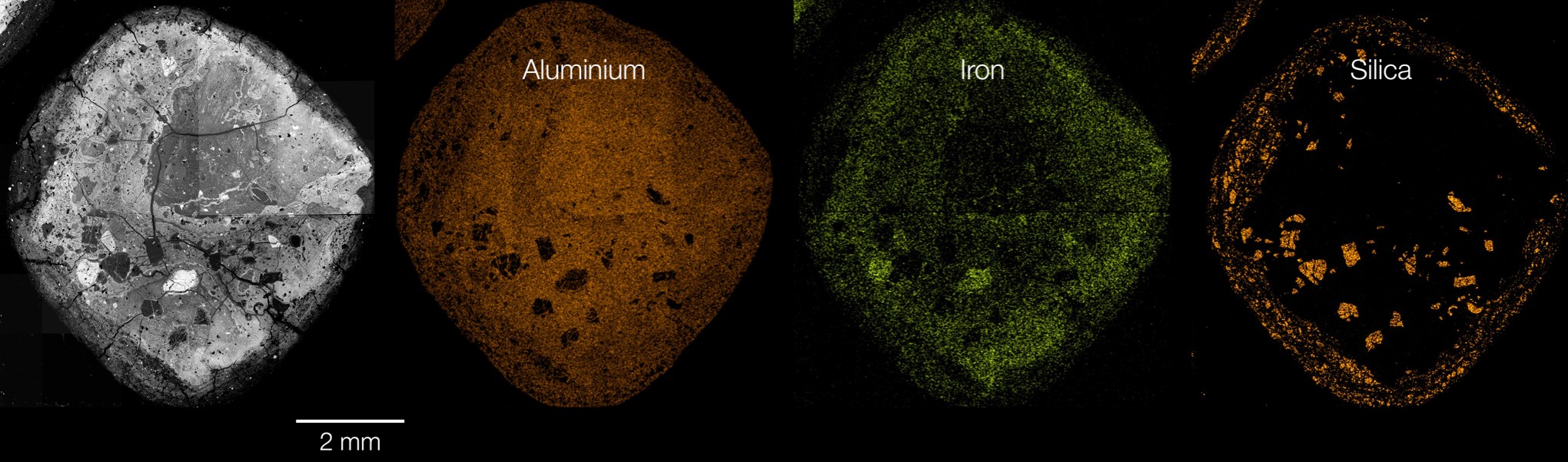
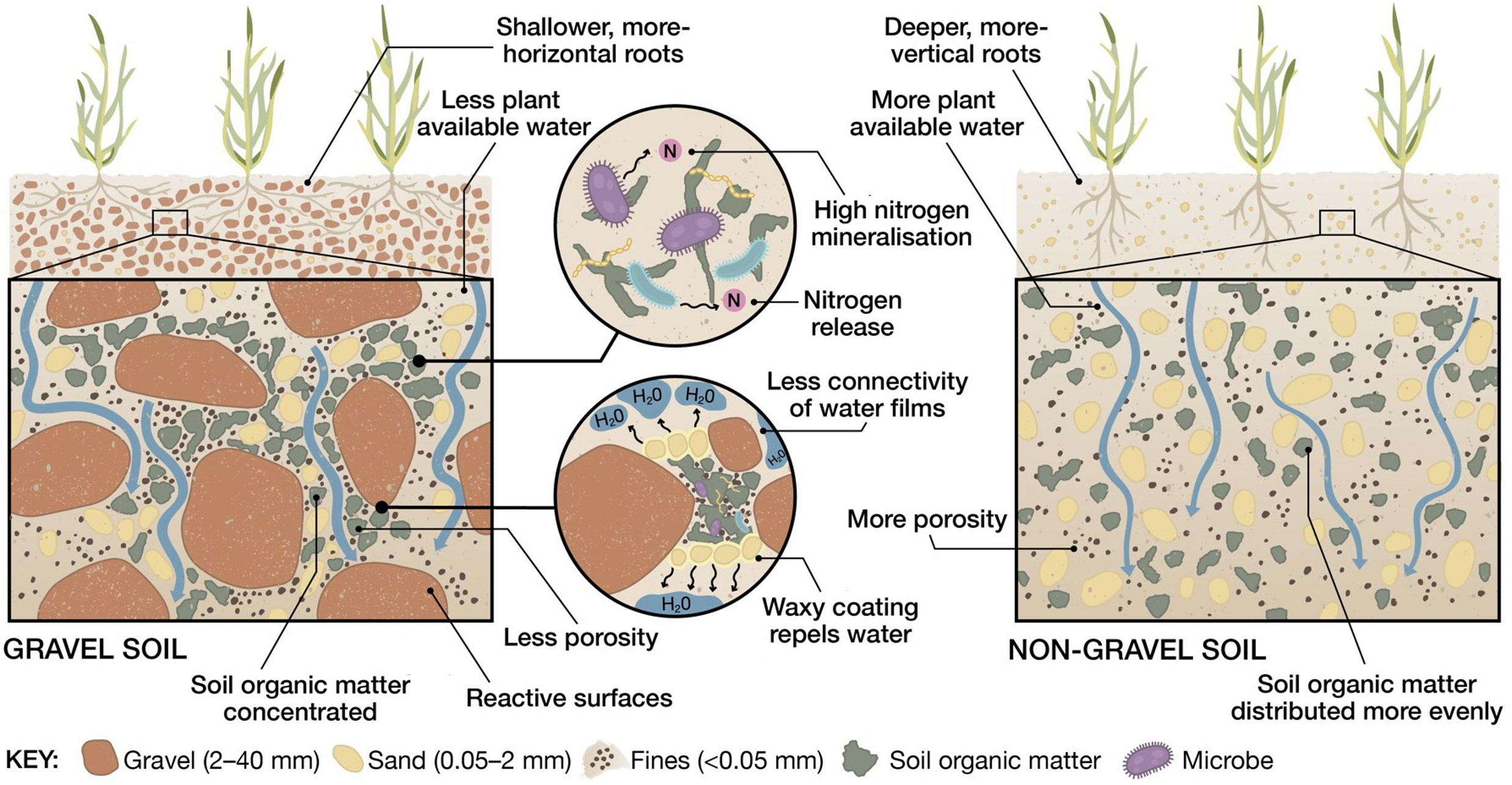
Gravel varies in porosity, which influences the extent of water and nutrient exchange within the soil profile. Gravel chemical composition influences internal gravel porosity. Silica dominated ironstone gravel is more porous, while those dominated by aluminium, and particularly iron, are less porous. Pore size and connectivity within individual gravel particles can influence movement of water, nutrients and habitats for soil microorganisms.
In general, increasing gravel content decreases whole soil porosity, pore connectivity and pore size distribution (depending on soil texture), resulting in less space for water storage. Sandy textured soil is more sensitive to increasing gravel content than finer textured soil; below 25% gravel, porosity is reduced by the elimination of small pores (which store water horizontally) decreasing water retention. However, at higher gravel content porosity may increase due to the creation of large macropores connected vertically, accelerating soil water drainage via preferential flow pathways.
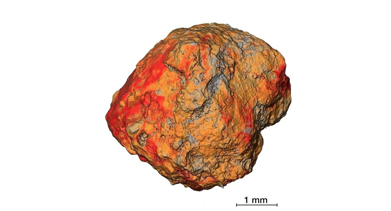
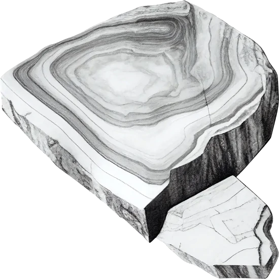
3D view of an individual gravel.
Internal pores in ironstone gravel particles provide additional water storage, new surfaces for nutrient binding and microhabitats for microorganisms. From Soil Quality: 9 Gravel Soil (Brailsford et al. 2023). Video animation: Jeremy Shaw, the University of Western Australia; audio: Francesca Brailsford, Murdoch University; editing: Science with Style.
Gravel particle have previously been considered inert and largely ignored, but recent findings suggest they can influence nutrient availability and soil water exchange. The presence and characteristics of gravel affects soil properties in the following ways.
The presence of ironstone gravel in soil changes the amount of water that a soil can store. The change to water storage occurs because of the differences in bulk density and pore-size distribution between soil, and ironstone gravel. The presence of ironstone gravel changes the pore size distribution of the soil, which is the dominant influence on how water is stored in soil.
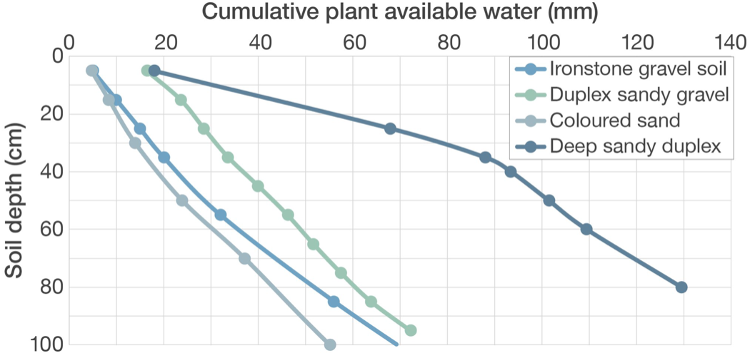
The effect of gravel on soil water storage can differ in saturated or very dry conditions – depending upon the physical properties of the soil and gravel. The figure below shows some modelled examples for a sandy gravel and loamy gravel soil based on measurements done in Western Australia.
In the example of a sandy gravel, the gravel is more porous and the amount of water that the soil can store at saturation increases as gravel content increases – but importantly, the amount of water that is retained by the soil in very dry conditions (which is inaccessible to crop plants), also increases.
In contrast, the modelled example for the loamy gravel shows a different effect under saturated conditions – the amount of water that the soil can store decreases as the level of gravel increases. This decrease occurs because the gravel is more dense, less porous, and has a lower capacity to hold water than in the first example.
In very dry conditions, increasing gravel in the loamy soil has the same effect as in the sand – the amount of water that the crop cannot access increases as gravel content increases indicating possible water deficits (dependent on season) and lower potential yield based on less plant available water.
In both examples, gravel content has minimal effect on soil water retention at intermediate soil water content.
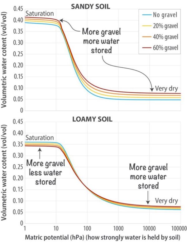
Modelled soil water retention curves for a sandy soil and a loamy soil with increasing amounts of gravel. Figure charts by Craig Scanlan, DPIRD; data Francesca Brailsford, Murdoch University; model of Parajuli et al. 2017; artwork Science with Style.
Soil thermal properties influence biological, chemical and physical processes and reactions in soil critical to plant growth. Gravel particles in the soil surface have the potential to alter the soil temperature, and the duration of exposure to that temperature, through their influence on heat exchange, thereby altering soil thermal properties.
Models of thermal capacity in gravelly soil show differing effects of gravel in dry and wet conditions. In dry conditions, gravel particles are likely to increase thermal capacity because the gravel particles have a greater thermal capacity than the soil particles. However, the impact of the thermal properties of the gravel particles is likely to be smaller than the changes in thermal capacity associated with soil water content, because water has a higher thermal capacity than gravel or soil particles. As a result, in wet conditions, the thermal buffering (slowing the rate of change) of soil to crops is likely to decrease as gravel content increases, and the opposite would be expected when the soil is dry.
Ironstone gravel particles, particularly those with iron and aluminium oxide coatings, are more resistant to weathering than most rock fragments. In addition, their profile position (close to the land surface) means they can protect landforms either through gravel-sized particles resisting raindrop displacement of soil particles and/or sheet erosion, or through the formation of duricrusts (hard surface, or near-surface layer) preventing the formation of water flow channels. This resistance is enhanced where the vegetation cover is persistent and deep rooted. As a result, ironstone gravel has strongly influenced landscape and soil development.
Ironstone gravel can have different properties from the surrounding soil matrix, for example, it may contain five to ten times the iron content of the soil matrix. Ironstone gravel soil is associated with old, deeply weathered landscapes. A number of processes are proposed to have led to ironstone gravel formation, including intense chemical weathering concentrating quartz sands and clay (mostly aluminium and silica-rich kaolinite) at the near-surface in addition to the accumulated iron, which can lead to large differences in physical properties of gravel soil. Biologically-mediated processes of ironstone gravel formation have also been proposed, through the interaction of microbial communities and native plant species within the soil profile.
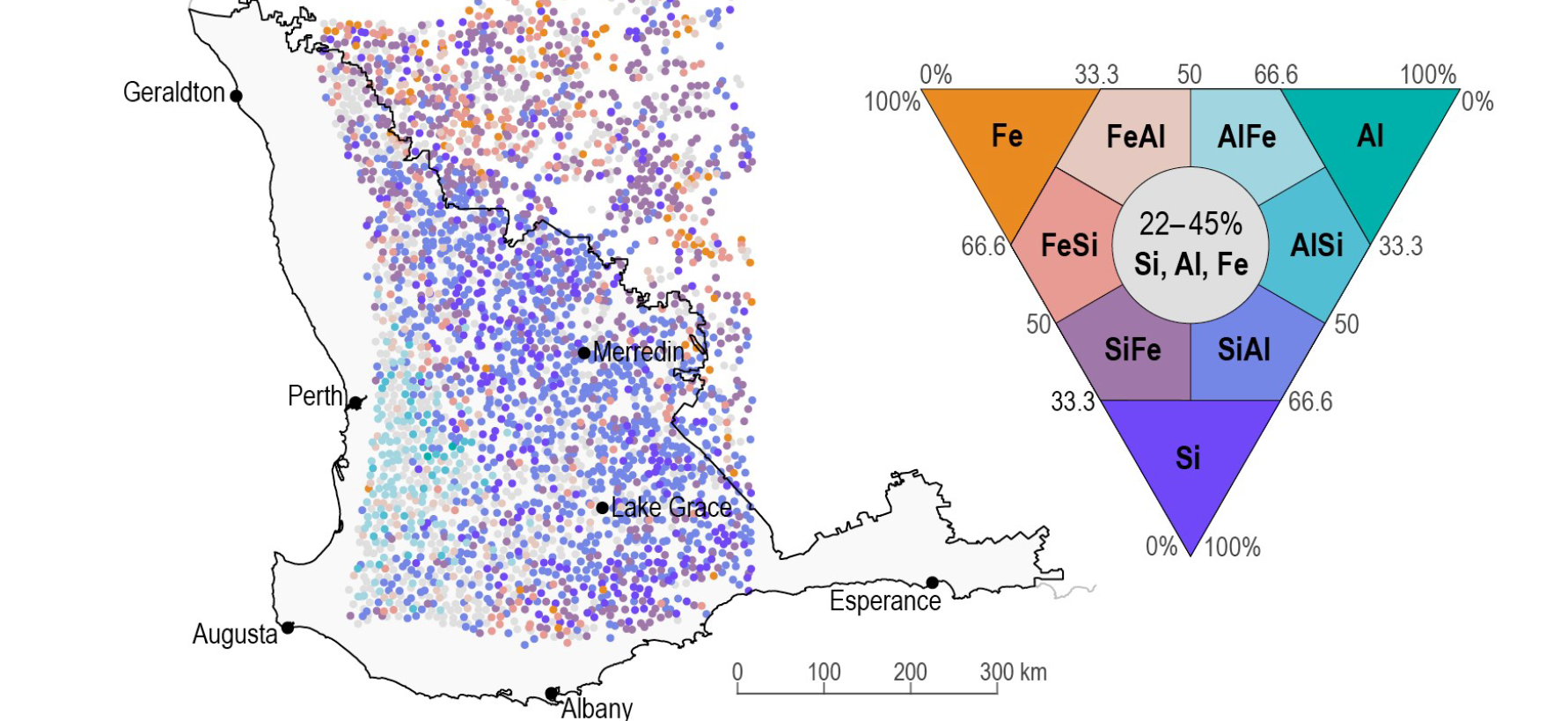
Diversity in gravel soil geochemistry across the south-western agricultural region of Western Australia. Iron, aluminium and silica content of gravel can vary widely across the south-western agricultural region. Gravel with different geochemistry can be present in the same areas, with variability even possible at a paddock scale. Map Karen Holmes, DPIRD; data Cornelius et al. 2007; surface ironstone gravel composition defined by Si, Al, and Fe oxide percentages shown in inset ternary diagram (Griffin et al. 2016); artwork Science with Style.
The impact of gravel in soil on water use efficiency of crop and pasture plants has not been examined in Western Australia, but based on research done elsewhere, the impact is likely to depend on how the gravel is distributed through the soil profile. Where greater than 20% gravel is present in the surface and subsurface, water use efficiency is likely to decrease as gravel content increases because the gravel particles create a more tortuous path for roots, reducing overall root length, and the capacity of the crop to capture water and nutrients. However, where an impenetrable gravelly subsurface horizon is present, the depth to this layer determines how much plant-available water can be stored and utilised by the crop. Water use efficiency is expected to increase as the depth to the impenetrable gravelly layer increases.
Current models are not capturing the full impact of gravel content on other soil hydraulic properties, for example, it has been demonstrated that a number of models underestimate the reduction of hydraulic conductivity in both sandy loam and silt loam soils with up to 15% and 30% gravel content respectively.
Crop yield is generally lower on soil with higher (above 20%) ironstone gravel content in medium and high rainfall environments, due to a decrease in the capacity of the soil to store water and nutrients compared to soil with less gravel. However, this relationship may be reversed when annual precipitation is below 300 millimetres (low rainfall) – possibly through a surface mulching effect that minimises evaporation, potentially increasing plant-available water and crop growth.

Modelled simulations of root growth in gravel soil show increased root density. Image Bill Bowden, DPIRD, retired. Modelled by Vanessa Dunbadin; modelled using ROOTMAP.
Gravel soil is most commonly found in the relatively high rainfall areas of the south-western agricultural region of Western Australia. Grain cropping currently only occupies a portion of this area, with the remainder comprising of permanent pasture, mixed farming, and areas of forest and nature reserves. Soil water repellence on gravel soil is often high to very severe. Topsoil organic carbon levels are often relatively high (>2%), which reflects the higher productivity of these areas. The organic compounds, including those that cause repellence, are concentrated in the soil matrix between the gravel particles. Because of this, and the relatively low surface area of gravel particles, the loamy gravel soil types may also be repellent, though it is most often more severe in the sandy gravel soil types. Soil water repellence tends to be expressed most readily on the hill tops and slopes, which have high gravel content, and readily shed water which then accumulates in lower parts of the landscape.
The proportion of gravel in soil changes the interpretation of soil nutrient availability measurements, which are usually performed in the laboratory on the less than 2-millimetre soil fraction and is often reported as a concentration for a given weight of soil. These results should be adjusted for the volume of gravel for a known depth to provide accurate estimates of nutrient availability.
Phosphorus
Ironstone gravel particles can have a surface rind of a few millimetres, that is more enriched with iron and aluminium minerals than the gravel core. This influences the surface reactions that are responsible for phosphorus (P) sorption capacity. Phosphorus availability in gravel soil is associated with soil properties of pH, extractable aluminium and iron, is influenced by fertiliser history, and can be measured as bicarbonate-extractable phosphorus (e.g. Colwell-P) or diffuse gradient thin-film phosphorus (DGT-P).
The iron and aluminium content of the fine (less than 2-millimetre) and coarse (above 2-millimetre) fractions of ironstone gravel soil is indirectly linked to the extent of phosphorus retention in soil across the south-western agricultural region. A more direct measure of phosphorus retention is phosphorus buffering index (PBI). Soil with a higher phosphorus buffering index (more iron or aluminium), can retain more phosphorus more strongly than soil with a low phosphorus buffering index. This results in soil with a high phosphorus buffering index requiring greater levels of phosphorus as measured by Colwell-P compared to soil with low phosphorus buffering index, to achieve maximum production.
Currently, it is unclear what impact the percentage gravel content and chemical composition within a soil profile, and the phosphorus distribution with depth, will have on the ability of crops to access soil phosphorus.

Nitrogen
As gravel content increases, the space (porosity, volume) remaining for plant and animal residues in soil decreases. This results in a concentration of soil organic matter in the soil fine fraction (less than 2-millimetre) between gravel particles. For example, a soil with 50% gravel would contain double the concentration of organic matter inputs (residues originating from living organisms) in the soil fine fraction compared to a soil without gravel receiving the same inputs. In Western Australia, data from 40 trials showed an approximate 50% increase in soil organic carbon with an increase in gravel content from 20 to 40%. How this concentration of organic residues between gravel particles influences soil organic matter decomposition and associated soil nitrogen (N) supply (net mineralisation) requires further understanding.
In theory, the concentration of water, microorganisms and soil organic matter within the available soil pore matrix that results as gravel content increases, could lead to faster rates of microbial soil organic matter breakdown and higher nitrogen mineralisation rates (i.e. a greater rate of soil nitrogen supply). Alternately, the concentration of soil organic matter in the spaces around the gravel particles may function to increase water repellence. This could decrease the connectivity of water films within the soil matrix, leading to a slowing of microbial decomposition of soil organic matter. This could also be exacerbated by the decrease in small-sized pores, which contribute to soil water storage, with increasing gravel content.
Both the gravel and soil fractions contain positively charged surfaces, which can slow nitrogen leaching by retaining nitrate (NO3-) on surfaces for longer (or in greater volume). The kaolinite clay, which constitutes a large part of the weathered fine fraction of ironstone gravel soil, has a higher anion exchange capacity (AEC) than most other soil minerals. This has been attributed to the replaceable hydroxyl (OH–) ions of its exposed aluminium layer. However, soil with high ironstone gravel content will have less pore space and less plant available water, resulting in higher rates of leaching through the whole soil. This will decrease contact time between the soil and nitrate, increasing the likelihood of nitrate loss by mass flow.
Assessing gravel soil
Gravel mineralogy, distribution, volume and depth of gravel in the soil profile influence soil water and nutrient exchange, yet are often unknown – historically having been considered inert and excluded from soil measurements. Only recently have quantitative methods that allow more accurate determination of whole soil properties been considered.
Two key constraints have made analysis of the gravel component of ironstone gravel soil challenging – the greater than 2-millimetre gravel fraction is usually discarded prior to soil analyses and methods for analysis of intact gravel particles is not mature.
Previously gravel was considered to have no impact on soil properties, leading to the standard processing step of sieving soil through a 2 millimetre sieve. Characterisation of gravel properties and their role in biological, chemical and physical soil processes indicate they are not inert.
Current analytical methods for gravel geochemical properties include grinding gravel samples into a homogenous fine powder, so that it may be analysed in a similar manner to the soil fraction. These destructive methods can significantly change some soil properties measured in the laboratory compared to what is encountered in the field. For example, grinding gravel particles to measure phosphorus adsorption will overestimate what could be expected to occur in the field (where gravel nodules remain intact). Most soil sampling units have an internal auger that may also crush some of the gravel. These factors are associated with exposure of internal mineral components creating more surface area for phosphorus to adhere.
Methods to better measure how gravel influences soil properties need to be explored that better reflect their influence in a field situation. Subsequent results also need to be adjusted to the relative gravel and soil volumes in the soil profile. This may require modification of current laboratory techniques (e.g. DGT-P), or incorporation of gravel soil knowledge into the methods of indirect rapid throughput measurements (e.g. portable X-ray fluorescence, spectroscopic techniques) that allow an understanding of gravel geochemistry on a broader scale.
As the gravel fraction has typically been discarded prior to analysis in soil testing laboratories, standard procedures for the preparation and handling of gravel soil, are not well developed. Basic measurements required to assess gravel soil properties and their impact on soil processes accurately are hindered by the physical characteristics of the gravel stones themselves – including interference with sample coring equipment and physical interception of probes (e.g. neutron density probes, soil moisture probes) pushed into the soil. This results in problems obtaining a representative sample in the field, interferes with sampling and measures for bulk density and identification of soil compaction.
As measurements of soil nutrient levels are routinely performed on sieved (less than 2 millimetre) soil samples, any potential supply or retention (tie-up) of nutrients associated with the gravel particles is not considered in fertiliser recommendations. Grinding of ironstone gravel particles to measure plant available phosphorus appears to have potential and is also useful for determining total elemental composition, but it is not suitable for estimating nutrient binding. This is due to the exposure of new nutrient binding surfaces as a result of grinding (that are not normally accessible for chemical reactions), which may lead to overestimating nutrient binding within the soil matrix and result in fertiliser recommendations that do not optimise return on investment.
Methods to better measure nutrient supply from the combined ironstone gravel and soil matrix need to be developed for soil testing laboratories. The proportion of gravel compared to the fine earth fraction in the soil profile also needs to be considered, in addition to whether gravel presents a physical barrier to crop roots reaching water and nutrients. Nutrient retention measurements therefore need to be done below the surface layer to provide a better picture of where nutrients are stored in the gravel soil profile and where plant roots are able to reach.
Sampling protocols for gravel soil
Whilst the standards for sampling gravel soil are yet to be established, the following techniques and strategies take into account the difficulties encountered when sampling gravel soil.
In soil without gravel or with a low proportion of gravel, samples are usually taken as cores. This technique is unsuitable for soil with a high proportion of gravel; in this case a 20 x 20 centimetre spade sample is recommended. Surface organic material such as crop residues, roots and animal manure should be brushed aside when sampling to prevent misleading and highly variable results, particularly for organic carbon. It is, however, important to leave the gravel (greater than 2 millimetre) fraction intact within the soil, so that gravel content can be accounted for within your results.
For most soil types, sampling at 0–10, 10–20 and 20–30 centimetres gives a good guide to the pH, nutrient and organic matter profile of your soil and can also detect toxicities like boron and chloride.
The most common depth for nutrient testing in the south-western agricultural region is 0–10 centimetres. Therefore, test results from that depth are usually correlated with fertiliser responsiveness. Deeper sampling (at least 10–20 cm) is useful for gravel soil, where the high level of nutrient (phosphorus and nitrate) immobilisation means that the plant growth response to fertiliser rates as determined by soil testing may differ from what is expected.
Paddock variability, particularly changes in soil type and areas that have different crop or pasture growth, should be taken into account when designing sampling programs. It is important not to under-sample; knowing and understanding ‘management areas’ within paddocks will allow targeted inputs to maximise economic return. Position in the landscape, soil survey and farmer knowledge, land use and management history, yield maps, imagery and visual interpretation can all help determine where there is a need to sample. Avoid unrepresentative areas such as stock camps, paddock corners, current and old fence lines, and harvest windrows.
Ideally, take soil samples in summer when most soils are hot and dry with minimal biological activity. This will minimise the impact of seasonal variation. Seasonal variation in pH can be further reduced by measuring pH in a calcium chloride solution rather than in water.
The number of sites and pattern of sampling will vary according to the size and evenness of the paddock, what is being grown and the soil parameters that are being tested. You will need to use your judgement, balancing sampling intensity with the number of paddocks you are able to sample and the management costs of the paddock. Use the following as a guide:
- In small pasture paddocks with little soil type variation, a zig zag or ‘W’ pattern of sampling, is appropriate, taking multiple samples, to provide a single bulked sample for the paddock.
- A large cropping paddock is likely to have management or soil type zones that will need to be taken into account. For gravel soil, usually about six sampling sites are selected across the width and length of the paddock, with two to three sampling sites in each zone with a 20 x 20 centimetre spade sample taken at each site.
Because soil can vary within a paddock, tracking changes to a paddock over time requires samples to be collected from the same location over time. Samples need to be properly geo-located, preferably by accurate global positioning system (GPS), to allow comparable repeat sampling. Unless they are properly set up, mobile phone apps can be inaccurate for getting correct GPS locations.
Mechanical soil mixing or incorporation of topsoil into the subsurface layers usually results in a highly variable soil profile. Monitoring changes in soil quality will be difficult and require more intensive sampling than usual. In some cases, it will be impossible to achieve meaningful measurements. Particularly where lime has been applied as part of the amelioration, it is best to leave testing to three years after the mixing.
For pH, spraying a face of a soil pit with universal indicator may help to indicate whether there are sufficient pathways of ameliorated soil for roots to grow to depth. However, without the benefit of traditional soil pH sampling, acidification rates will need to be carefully estimated to determine ongoing lime requirements.
Bulk density measurement in gravel soil profiles is of particular importance because it is currently the only feasible approach to measure compaction in this soil type, and therefore, it is likely to be a critical factor in explaining crop yield responses to tillage treatments.
The susceptibility of ironstone gravel soil to compaction is influenced by both soil moisture and fine soil texture at low to medium gravel contents. While there is a general effect of increasing resistance to root penetration in soil with higher gravel contents, the compression of fine particles is not significantly affected by moderate to low gravel content. This changes with increasing gravel content associated with two different mechanisms:
- As soil moisture increases associated with higher gravel content, susceptibility of the fine earth to compaction also increases.
- Very high gravel content forms a supporting skeleton and more widely distributes compressive forces from vehicular traffic, thereby decreasing the risk of soil compaction.
Bulk density is less frequently measured than other soil properties, particularly in gravel soil where it is time and labour intensive. However, if you are interested in monitoring changes in soil organic matter over time, it is necessary to adjust the soil organic carbon percentage to an equivalent soil mass to account for changes in soil compaction over time. To do this, bulk density must also be measured. However, because bulk density is less variable than soil organic carbon, usually you only need one measurement for each sampling depth at each site. Knowing the bulk density of your soil will also allow you to convert nutrient test results from a percentage or weight per kilogram to tonnes per hectare. Common techniques for measuring bulk density on gravel soil include the excavation method and nuclear density meter (NDM) readings, although new methods such as three-dimensional (3D) scanning have been trialled in recent years.
Measuring bulk density in gravel soil by the excavation method
- Dig a hole and weigh the soil removed.
- Determine the volume of the void – either by recording the volume of sand or water required to fill the void, or by filling the void with plaster to form a mould and measuring the volume of water it can displace.
- Calculate the bulk density (g/cm3) – the weight of the soil from the hole in grams divided by the volume of the hole in cubic centimetres (1 millilitre = 1 cubic centimetre).
Further reading
Tool or calculator Gravel and bulk density calculator
This soilquality.org.au calculator converts raw soil analysis results into values on a per hectare basis, accounting for both the bulk density and gravel content of the soil.
Managing gravel soil
At present, our understanding of how to use information on the properties of ironstone gravel soil to guide agronomic decisions is limited. Soil gravel content is rarely measured in field experiments, is almost always excluded in glasshouse experiments, and is discarded in commercial soil testing, which constrains our ability to relate to crop responses.
- Assuming uniform distribution, soil with less than about 20% gravel behaves similarly to non-gravel soil.
- Crop root growth can be adversely affected by high soil gravel content.
- In medium-high rainfall conditions, crop yield decreases in response to increasing soil gravel content.
- Crop yield may be increased by the presence of surface gravel in low (< 300 mm) rainfall conditions where it forms a near-surface mulch and decreases evaporation.
- The use of tillage operations that redistribute gravel to the surface to create a mulch may be of benefit in low rainfall areas.
Plant available water
Agronomic decisions using yield potential estimates as a basis for calculating the optimum level of product application need to also account for changes in water flow and plant available water capacity, including the influence of the gravel fraction on soil permeability.
The main effect of gravel on soil physical properties is the decrease in volume of the soil matrix (particles less than 2 millimetres); the available water capacity is altered in proportion to the amount of gravel present. This can affect the amount of water stored at field capacity and the ability of plants to access water and soluble nutrients as soil dries (lower limit of soil water).
Characterising soil profiles to identify soil texture, gravel content and depth to gravel (or other impermeable layers) will determine the management implications of changes in soil water. Gravel soil can be susceptible to drought and/or waterlogging depending on rainfall, the depth of the gravel layer, permeability of the underlying soil and topsoil texture. For example, plant available water capacity of ironstone gravel soil can be similar to soil without gravel and a similar texture – but may also differ based on the upper and lower drained limits. This is influenced both by gravel content and the porosity of the gravel.

Nutrient management
Phosphorus
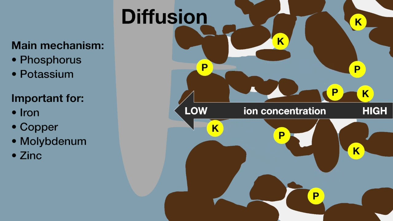
Crop plants mostly access phosphorus via diffusion. When roots take up phosphorus from the soil at the root interface, the concentration drops and a difference in concentration between the soil at the root surface and the surrounding soil develops, leading to a ‘concentration gradient’. Phosphate ions move towards the root surface as the concentration gradient develops, but the rate of this movement, diffusion, depends upon soil water content, root-induced changes to the rhizosphere and the phosphorus binding behaviour of both the soil and gravel.
Phosphorus binding to gravel soils involves a complex interplay of chemical and physical processes, with important implications for nutrient (fertiliser) use efficiency and plant growth. For example, in Western Australian soils where gravel is iron dominated, more than 60% of the phosphorus (Colwell-P) has been measured associated with the gravel fraction when considered with the less than 2-millimetre fraction in soil. Understanding these processes is essential for developing effective strategies for managing soil phosphorus fertiliser addition and maximising plant yields.
Soluble nutrients
Gravel causes soil to drain faster, causing soluble nutrients to move deeper into the soil profile at a rate faster than roots grow. As a result, the rooting zone of gravel soil may have lower soluble nutrient content (nitrogen, sulphur and potassium) unless regular nutrient inputs are supplied. It is important to consider the specific characteristics of gravel soil and its nutrient-holding and exchange capacity when determining fertiliser application rates and frequencies. Soil and/or tissue testing and splitting fertiliser applications during the growing season can also help to match nutrient availability with plant demand, minimising losses. Soil and plant tissue testing is of high importance, along with an understanding of the way gravel alters nutrient availability when making fertiliser decisions.
Carbon sequestration
Gravel content needs to be considered in carbon accounting for gravel soil types, especially when determining subsoil carbon stocks. Research from a long-term experiment showed that within the surface soil (0–30 centimetres; where most of the soil organic carbon is located) only about 5% of the total organic carbon was attached to the gravel particles. While at depth (100–180 centimetres) where there is much less soil organic carbon, up to 40% of the total carbon was attached to the gravel.
Gravel also has significance for assessing agricultural carbon stocks and needs to be included in strategies to sequester soil carbon long-term. Typically, gravel is removed from the fine soil (less than 2 millimetre) fraction before analysis, but it is essential to account for the volume of soil displaced by gravel present.
Managing physical and chemical constraints
Plant growth can be impacted by soil gravel content, location and density. Based on limited evidence, it appears that crop root architecture when grown on a gravel soil will be different to a soil without gravel. As gravel content and density increases, root depth decreases. This is most likely due to the physical barrier of gravel particles to root growth causing lateral spreading of the roots – limiting access to deeper moisture. It is important to be aware of limitations to plant growth and manage fertiliser inputs and crop or pasture choice accordingly.
Tillage to overcome compaction, to bury water repellent soil or to mix lime into acidic soil can alter the spatial distribution of rock particles in gravel soil, bringing more and larger particles into the soil surface. These gravel particles make it difficult to achieve good seed-to-soil contact, which is necessary for germination and plant establishment. Rolling can be used to create a more level seedbed prior to seeding.
Within ironstone gravel soil profiles it is common to find areas of cemented laterite, in addition to large lateritic rocks in the soil profile. These will exacerbate the lack of water storage and physical barriers to root growth in these soils. Crushing very large cemented laterite and rocks into smaller fragments can reduce these constraints in targeted problem areas. However, caution should be taken with crushing smaller gravel particles across whole paddocks, particularly in areas of iron-rich gravel, as this will create more available surface area for nutrient binding.

Grower experience of managing gravel soil.
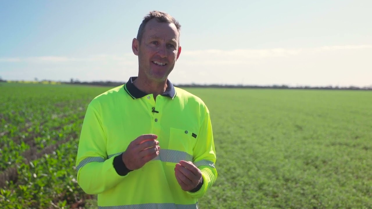
Mark Fowler, farmer at Williams, discusses challenges and management practices for farming on gravel soil. From Soil Quality: 9 Gravel Soil (Brailsford et al. 2023). Original video: GRDC; edited for Soil Quality: 9 Gravel Soil (Brailsford et al. 2023): Science with Style.
Page references and acknowledgements
Material on this page adapted from:
- Brailsford F, Scanlan C, Weaver D, Holmes K and Leopold M (2023). Soil Quality: 9 Gravel Soil. SoilsWest, Perth, Western Australia. [Access]
Last updated July 2024.